Wedding car service · Kfar Saba
Wedding Car Rental in Kfar Saba
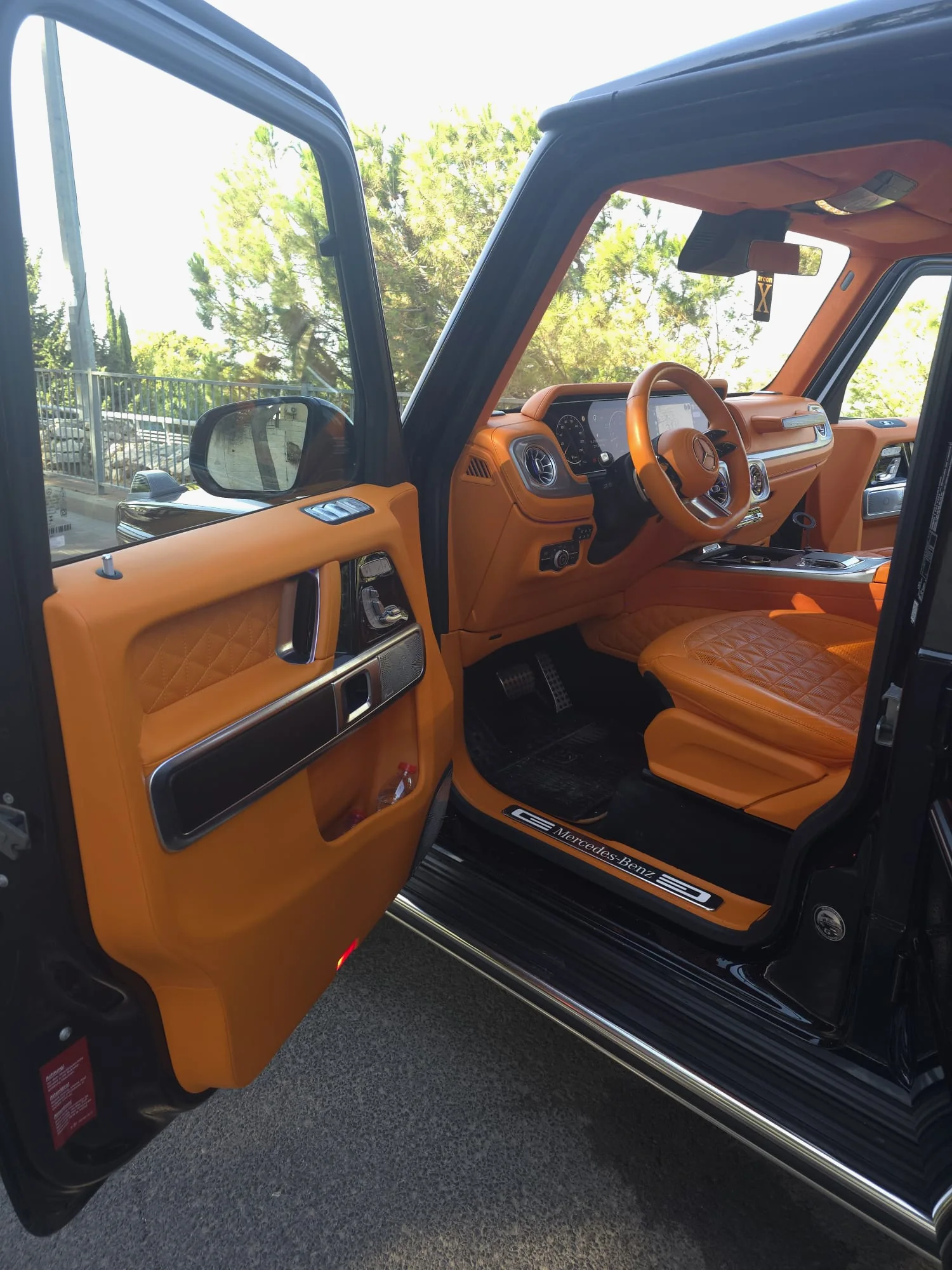
Kfar Saba grew out of orange groves. Jewish workers settled here in 1903 and planted almonds first, but the red soil turned out to suit citrus, and by the end of the 1920s groves ringed the village. The fruit still sits on the city emblem, beside the old khan. That story gives a wedding car rental in Kfar Saba real material: stone on Weizmann Street, a grove owner's summer house and a big park on the east side.
The town began as a moshava, an early Jewish farming village where each family owned its land, and Weizmann Street was its spine. Today the city sits between Route 4 on the west and Route 6 on the east, with Route 531 along its southern edge. A note for this year: Weizmann Street has been under renovation since June 2026. Whether your G-Wagon wedding car comes with a chauffeur or you drive it, fix every stopping point before the morning.
01 · Kfar Saba
Why couples in Kfar Saba choose the G-Class
A town that lived on citrus
In the 1930s citrus was Kfar Saba's main employer, and each winter, through picking, packing and shipping, hundreds and at times thousands of laborers worked the groves. The Founders' Trail, opened in 2009, links sites from that era, including a stop on orchard farming. Pictures taken along it carry that history without a caption.
The khan that became City Hall
In the Middle East a khan was a roadside inn; here the name belongs to the village's first public building. The settlers paid for it themselves in 1906: one story, 30 by 10 meters, under a tiled roof. The first well was dug behind it that year, and two eucalyptus trees from then still stand. Today it houses the municipality.
Ponds where you'd expect a lake
Yitzhak Wald Park opened in 2008 on about 250 dunams (62 acres) next to Levita Stadium. There's no lake, but there is water: an ecological pond at the west entrance and a winter pool of 1,100 cubic meters filled only by rain. Brightly painted iron sculptures by Nitzan Yoel Avidor stand between the lawns.
02 · Pickup
Pickup on the day in Kfar Saba
Since June 28, 2026, the renewal has been working its way along Weizmann one section at a time, and curbside parking on the active stretch is partly blocked, at times even after hours. If home or a photo stop is on Weizmann, don't count on pulling up at the door. The city points drivers to nearby public lots such as Tel Hai 37, Herzl 42 and the market lot at Giborei Israel 4; make one your meeting point.
Typical pickups
- Getting ready near Weizmann and Herzl, then meeting the car at a public lot
- A home in Ganei HaSharon or Kfar Saba HaTze'ira, on the park side of town
- A short photo stop outside the khan at 135 Weizmann Street
- A winter wedding, with portraits by the rain-fed pool in the park
03 · Photos
Photo stops with the car in Kfar Saba
- 01
The khan and its eucalyptus trees, 135 Weizmann Street
The long stone khan of 1906, its tiled roof and two eucalyptus trees from the founding years give a black car a frame of old stone and tall trunks. The village's first well sits behind it, and the khan is the centerpiece of the city emblem.
This is the working City Hall, and the Weizmann renewal adds lighting for the historic buildings around it. Shoot from the sidewalk, and check with City Hall before a professional crew sets up.
- 02
Beit Aharonovich (Beit Sarah), 73 Weizmann Street
A white summer house in an eclectic style, built in the late 1920s by Ben-Zion and Sarah Aharonovich on a rise above about 100 dunams of the family's groves (a dunam is 1,000 square meters). People called it "the palace." It was listed for preservation in 2013.
A WIZO center operates here today, so photos are from the street; the garden only with permission.
- 03
Kiryat Sapir and the water-lily pool
The city's cultural complex, near the pedestrian mall, Arim Mall and City Square. Beit Sapir holds the archaeological museum and a mosaic courtyard, and a water-lily pool sits on the grounds. The Founders' Trail sets out from here past 14 historic sites.
A busy public complex with a museum and a concert hall; clear a professional photographer with the venue first.
- 04
Yitzhak Wald Park (Kfar Saba Park)
An ecological pond greets you at the west entrance. In the southern section, added in 2009, a winter pool recreates the seasonal wetland once common across the Sharon plain. Colorful iron figures line the paths, among them David and Goliath in yellow and blue: playful after the stone of downtown.
Open daily 5:30 a.m. to 11 p.m., Saturdays included; entry is free. Lots beside the park charge non-residents.
05 · The route
Planning the drive in Kfar Saba
Route 531 is the southern gateway. The expressway opened along its full length in 2017 and has four interchanges along the city: Elishama, where it meets Route 40; Tel Hai; Sokolov; and Kfar Malal, where it meets Route 402. To the west it runs past Ra'anana to Route 4; to the east it ends at the Horshim interchange on Route 6.
Inside the city, the route depends on which stage the Weizmann works have reached. The municipality announces each stage and its closures by text message and WhatsApp; in the first stage, the turn from Tel Hai Street into Herzl Street closed during working hours.
- Route 531: Elishama, Tel Hai, Sokolov and Kfar Malal interchanges
- Route 4: Kfar Saba–Ra'anana North interchange
- Route 55: Kfar Saba East junction to Neve Yamin junction
- Route 6: Horshim interchange
- Weizmann Street: renovation in sections since June 2026
06 · Chauffeur or self-drive
A wedding car with a chauffeur in Kfar Saba
While Weizmann is torn up, driving in the old center takes patience: narrowed lanes, a turn that closes during working hours, parking that vanishes as the crews move. A chauffeur can let you out at the khan or Beit Aharonovich, wait in one of the public lots nearby and come back when the photographer is done. If you drive yourselves, save the city's list of lots on your phone and check the closures that morning.
07 · Nearby
Near Kfar Saba
08 · Booking
How booking works
- 01
Send your details
Your date, the city and rough hours, on WhatsApp, by phone or with the form.
- 02
We check the date
We check availability and get back to you with a clear quote.
- 03
Confirm and reserve
Once you confirm the booking, the date is held for you.
- 04
Plan the day together
Addresses, times, the route and photo stops, a few days before the wedding.
09 · Questions
Questions about a wedding in Kfar Saba
What should we know about the Weizmann Street works before our date?
Each section is planned to take about a year: roughly three months of night work on the water mains, Sunday to Thursday (the Israeli work week) from 9 p.m. to 5 a.m., then about eight months of day work, 7 a.m. to 5 p.m. At night one direction closes along the work zone; by day the lanes narrow but traffic runs both ways. Sign up for the municipality's updates well before the wedding.
Is there a lake in Kfar Saba for photos?
Not a large one. Yitzhak Wald Park has ponds instead: an ecological pond by the west entrance and a winter pool fed only by rainwater, which shelters birds, reptiles and amphibians. Kiryat Sapir has a water-lily pool. If you want open water, Ra'anana Park in the neighboring city has a triangular lake at its center, and it can fit into the day's route.
When is Yitzhak Wald Park open, and where do we park?
Every day from 5:30 a.m. to 11 p.m., Saturdays and holidays included, with last entry at 10:45 p.m. Entry is free. Gates open from the stadium lot at Derech HaPoel 35, from HaGalil and Ben Yehuda streets, from Har Tavor Street, and from Weizmann Street into the southern section. The lots next to the park are paid for anyone who isn't a Kfar Saba resident.
Sources for this page (18)
- Wikipedia (EN): Kfar Saba (Jewish workers on the site from 1903; almonds, then citrus; arcaded storefronts on Weizmann Street)
- Wikipedia (EN): Moshava (privately owned land, as opposed to the kibbutz and the moshav)
- Wikipedia (HE): Kfar Saba (about 2,000 dunams of groves by the late 1920s; citrus in the 1920s and 1930s; emblem with the khan, eucalyptus and citrus; Kiryat Sapir and the water-lily pool; Routes 4, 6 and 531; Ganei HaSharon and Kfar Saba HaTze'ira)
- HaMichlol: Weizmann Street, Kfar Saba (the historic main street; arcade in front of the shops)
- Wikipedia (HE): Kfar Saba City Hall (the 1906 khan, 30 × 10 m, tiled roof, first well and two eucalyptus trees, 135 Weizmann St)
- Wikipedia (HE): Beit Aharonovich (eclectic summer house of the late 1920s above the family groves, "the palace," preserved 2013, WIZO Beit Sarah, 73 Weizmann St)
- Wikipedia (HE): Founders' Trail, Kfar Saba (opened 2009, starts at Beit Sapir, 14 sites; citrus as the main employer; the khan's public use)
- Wikipedia (HE): Kfar Saba Park (named for Yitzhak Wald, opened 2008, 250 dunams by Levita Stadium, ecological pond, rain-fed winter pool)
- Wikipedia (HE): Yitzhak Wald Park (southern section 2009, winter pool, sculptures by Nitzan Yoel Avidor)
- Kfar Saba Municipality: getting to the park (gates, paid lots for non-residents, open 05:30–23:00 including Saturdays, free entry)
- Kfar Saba Municipality: urban nature (1,100-cubic-meter winter pool, hamra soil)
- Kfar Saba Municipality: Weizmann Street renewal, Q&A (three sections from June 28, 2026; night and day stages and hours; alternative public car parks; lighting for the historic buildings in the khan compound)
- Kfar Saba Municipality: Weizmann project traffic arrangements (closures during working hours, Tel Hai–Herzl turn, SMS and WhatsApp updates)
- Wikipedia (HE): Route 531 (fully open 2017; Elishama, Tel Hai, Sokolov, Kfar Malal, Ra'anana South and Horshim interchanges)
- Wikipedia (HE): Route 55 (east from Kfar Saba; crosses Route 6 without an interchange; Neve Yamin junction)
- Wikipedia (HE): Kfar Saba–Ra'anana North interchange (Route 4, Menachem Begin Blvd)
- Wikipedia (HE): Kochav Yair–Tzur Yigal (eastern Sharon, at the western foot of Samaria)
- Wikipedia (EN): Ra'anana Park (triangular lake at its center)

Availability