Wedding car service · Be'er Sheva
Wedding Car Rental in Be'er Sheva
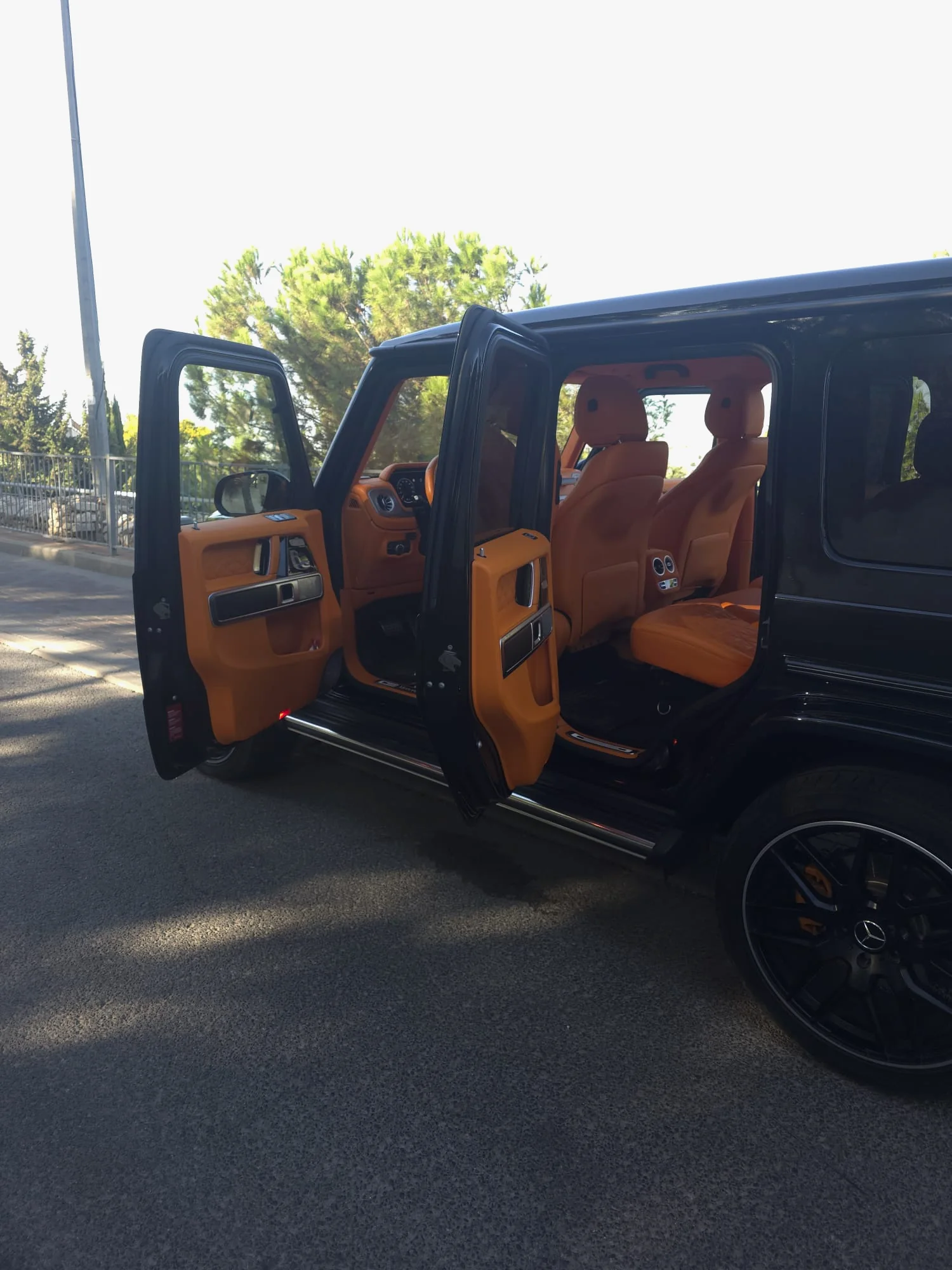
Be'er Sheva is known as the capital of the Negev, Israel's southern desert, and the desert sets the timetable. In July and August the average daily high is close to 35°C (about 94°F), with dry air. So a wedding car rental in Be'er Sheva is as much about the clock as about the black G63: photos in the early morning or the hour before sunset, and the hottest part of the afternoon spent indoors or on the road.
The city has backdrops you won't find on the coast: the straight streets of the Ottoman Old City, the arched Turkish railway bridge over the Be'er Sheva stream, the river park's lake, and a raw-concrete monument facing the desert. Below: photo stops, pickups in a city whose older neighborhoods are named by Hebrew letters, and the roads out. Have a driver, or take the wheel of the G-Wagon yourselves.
01 · Be'er Sheva
Why couples in Be'er Sheva choose the G-Class
Desert light, open horizon
The city sits on fairly flat ground ringed by pale loess, a fine wind-blown soil, and low ridges. In late-afternoon sun the black car stands out against the horizon and a white dress picks up warm tones. From high ground such as the Negev Brigade Monument, city and desert share one frame.
An Ottoman street grid
The Ottomans began building the Old City in 1900 on a plan of 60 square blocks, each 60 by 60 meters. The straight streets give long, symmetrical sightlines, made for a car parked dead center. Until the 1980s this was the business district, and revival work has gone on since 2009.
Hot days, gentler evenings
Summer is hot and dry, and dust storms can haze the sky, in summer and on some spring and autumn days. Build the schedule around that: early or near-sunset photos, short hops between stops, time inside the car rather than on hot pavement. The makeup holds, and you reach the reception fresh.
02 · Pickup
Pickup on the day in Be'er Sheva
Most of Be'er Sheva's neighborhoods were built north of the Old City and named in Hebrew alphabetical order, from Aleph (A) to Yud-Aleph (the eleventh), with a few letters skipped: locals say Shchuna Gimmel or Shchuna Daled. Ramot, Neve Ze'ev, Neot Lon, Nahal Ashan and Nahal Beka came from the 1990s on. With your address, send the neighborhood and say whether there's room to stop by the entrance.
Typical pickups
- Leaving a parents' home in Gimmel or Daled, with photos in the Old City
- A bride at a makeup studio in town and a groom joining from another address
- A couple from Omer or Meitar coming into the city along Derech Hevron
- Sunset at the Negev Brigade Monument, then straight on to the venue
03 · Photos
Photo stops with the car in Be'er Sheva
- 01
The Old City and Smilansky Street
Most houses on Smilansky Street, in the south of the quarter, are single-story stone buildings from Ottoman and British times, with high ceilings, arches and inner courtyards. The former Governor's House now holds the Negev Museum of Art, and the Great Mosque of 1906 stands nearby.
The Keren Kayemet pedestrian mall is closed to traffic; a side street works for the car. Ask the municipality about a professional shoot.
- 02
The Turkish railway bridge
Built in 1916 for the Ottoman railway, this bridge of dressed yellowish stone spans the Be'er Sheva stream for about 190 meters on 20 semicircular arches. Restored, it now carries walkers and cyclists and is lit at night. The restored 1915 station, with a steam locomotive, stands to its north.
No cars on the bridge. Ask the station complex in advance about a professional photographer.
- 03
The lake and Imber Promenade, Be'er Sheva River Park
The river park runs about 8 kilometers, from Tel Be'er Sheva to Neve Ze'ev. Its artificial lake of about 90 dunams (22 acres) has bridges, islands and lawns, and the Imber Promenade follows the northern bank. After dark, the pipe bridge glows in changing colors.
The park paths are for walking and cycling only.
- 04
The Negev Brigade Monument
Dani Karavan's raw-concrete memorial, built between 1963 and 1968 on a hill east of the city near Route 40, with an 18-meter observation tower. It looks west over the city and out to desert on every other side. In late light its hard geometry frames the car cleanly.
It honors the fallen of the Palmach's Negev Brigade (the Palmach was the pre-state strike force). Keep photos respectful and off the memorial elements.
- 05
Tel Be'er Sheva National Park
An ancient mound on the road to Shoket junction, south of Omer, listed as a UNESCO World Heritage Site in 2005. The remains of the biblical city, its storehouses and water system among them, and the view all around give you bare stone and quiet desert space.
Wedding photos by couples on the permitted paths need no advance permit, but entry is paid. The Authority also lists the site for family ceremonies by arrangement.
05 · The route
Planning the drive in Be'er Sheva
Be'er Sheva sits where Routes 25, 40 and 60 meet. From the center of Israel, Route 6 currently ends at the Shoket interchange, between the city and Meitar, linking to Routes 31 and 60. Route 406 is the main northern entrance and becomes Rager Boulevard, the city's main artery; Route 40 bypasses Be'er Sheva on the east.
Route 25 comes in from the northwest, from Ofakim, Netivot and Ashkelon, and continues southeast to Dimona. Route 60, called Derech Hevron in town, heads northeast toward Omer, Meitar and Arad. Expect many roundabouts, worth remembering with a long dress in the back seat. For a venue out of town, shoot in the city first and leave the highway for last.
- Route 6: ends at the Shoket interchange
- Route 406 / Rager Boulevard
- Route 40: the eastern bypass
- Route 25: northwest to Ashkelon, southeast to Dimona
- Route 60: Derech Hevron
06 · Chauffeur or self-drive
A wedding car with a chauffeur in Be'er Sheva
Booking a wedding car with a driver in Be'er Sheva takes everything outside the frame off your hands. Roundabouts are a fixture of the streets, the Old City's pedestrian mall is closed to traffic, and at the edge of the river park you need a legal place to stop. When someone else drives, you aren't maneuvering a large SUV in a gown, or hunting for parking in midsummer heat.
Good to know
Guests from Australia, New Zealand and Britain
Overseas guests may know the city's name from October 31, 1917, when Australian Light Horse regiments charged the Ottoman lines in the Battle of Beersheba. The city's Commonwealth war cemetery and the Park of the Australian Soldier remember that campaign: places for a quiet family visit around the wedding, not for photos with the car.
07 · Nearby
Near Be'er Sheva
08 · Booking
How booking works
- 01
Send your details
Your date, the city and rough hours, on WhatsApp, by phone or with the form.
- 02
We check the date
We check availability and get back to you with a clear quote.
- 03
Confirm and reserve
Once you confirm the booking, the date is held for you.
- 04
Plan the day together
Addresses, times, the route and photo stops, a few days before the wedding.
09 · Questions
Questions about a wedding in Be'er Sheva
Is the Old City a good place for photos with the car?
Yes, on streets where driving and stopping are allowed; the Keren Kayemet pedestrian mall itself is car-free, so the car stands on a nearby street. The grid lets you shoot down a long, straight street with the car at the far end and you both in front. The quarter sometimes hosts cultural events, so check the municipal calendar for your date.
Can we add photos at Tel Be'er Sheva National Park?
Yes. The Authority's photography procedure lets couples take private wedding photos on the paths and viewpoints open to visitors, with no advance request. The park closes in the afternoon, before sunset, so it suits a morning shoot rather than golden hour. Check the current opening hours on the Authority's website before you fix the schedule.
Sources for this page (23)
- Wikipedia (EN): Be'er Sheva (capital of the Negev; climate, July and August mean maximum 34.7°C, summer dust storms; Ottoman grid around 1900; neighborhoods named by Hebrew letters; Highways 6, 25, 40, 60 and 406; many roundabouts)
- Wikipedia (HE): Be'er Sheva (climate, loess, neighborhoods A to 11 and the newer neighborhoods, Route 406, roads)
- Wikipedia (HE): Old City of Be'er Sheva (1900, 60 blocks of 60 × 60 m, business center until the 1980s, conservation since 2009, Keren Kayemet mall, Governor's House, Great Mosque 1906)
- Wikipedia (HE): Smilansky Street, Be'er Sheva
- Wikipedia (HE): Be'er Sheva River Park (about 8 km, 90-dunam lake, Imber Promenade, lit pipe bridge, Turkish bridge of 1916, 190 m, 20 arches)
- Be'er Sheva Municipality: Be'er Sheva River Park
- Be'er Sheva Municipality: restoration of the Turkish bridge as a pedestrian crossing
- Wikipedia (EN): Turkish railway station (opened October 1915; restored 2013; steam locomotive on display)
- Wikipedia (HE): Turkish railway station, Be'er Sheva (north of the bridge)
- Wikipedia (HE): Negev Brigade Monument (Dani Karavan, 1963–1968, hill east of the city near Route 40, 18 m tower)
- Tiuli: Negev Brigade Monument
- Israel Nature and Parks Authority: Tel Be'er Sheva National Park (location, opening hours, entry fees)
- Israel Nature and Parks Authority: photography procedure in nature reserves and national parks (section 1.3)
- Israel Nature and Parks Authority: family ceremonies, price list and list of sites
- Wikipedia (EN): the 1917 battle for the city (October 31, 1917; Australian Light Horse charge; Park of the Australian Soldier; war cemetery)
- Wikipedia (EN): Shoket Interchange (the southern end of Highway 6)
- Wikipedia (HE): Route 40 (Be'er Sheva bypass)
- Wikipedia (HE): Route 25
- Wikipedia (HE): Route 60
- Wikipedia (HE): Route 31
- Wikipedia (HE): Yitzhak Rager Boulevard
- Wikipedia (HE): Omer
- Wikipedia (HE): Lehavim
Availability